


A new tornado watch has been issued that includes several Alabama counties:
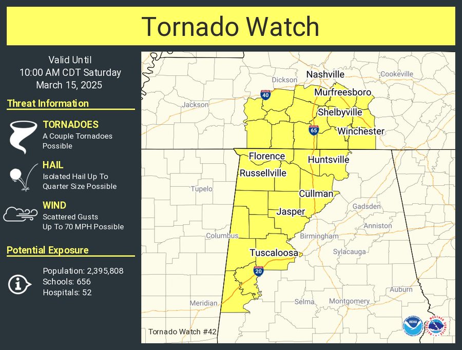
Here is the full messaging from the SPC:
   The NWS Storm Prediction Center has issued a

   * Tornado Watch for portions of
     Western and Northern Alabama
     Southern Middle Tennessee

   * Effective this Saturday morning from 235 AM until 1000 AM CDT.

   * Primary threats include...
     A couple tornadoes possible
     Scattered damaging wind gusts to 70 mph possible
     Isolated large hail events to 1 inch in diameter possible

   SUMMARY...A cluster of severe thunderstorms will continue northeast
   on the eastern periphery of a moist and unstable warm sector.  A few
   supercells will be potentially capable of a tornado risk, as well as
   a risk for damaging gusts and perhaps some hail through the early
   morning.

   The tornado watch area is approximately along and 55 statute miles
   east and west of a line from 100 miles north of Huntsville AL to 40
   miles south of Tuscaloosa AL. For a complete depiction of the watch
   see the associated watch outline update (WOUS64 KWNS WOU2).

   PRECAUTIONARY/PREPAREDNESS ACTIONS...

   REMEMBER...A Tornado Watch means conditions are favorable for
   tornadoes and severe thunderstorms in and close to the watch
   area. Persons in these areas should be on the lookout for
   threatening weather conditions and listen for later statements
   and possible warnings.
Be sure to have multiple ways to receive alerts in the event of a warning being issued for your location.
Category: Alabama’s Weather, ALL POSTS, Severe Weather, Social Media