
Weather Briefing: Finally, A Dry Saturday; A Chance of Storms on Sunday : The Alabama Weather Blog


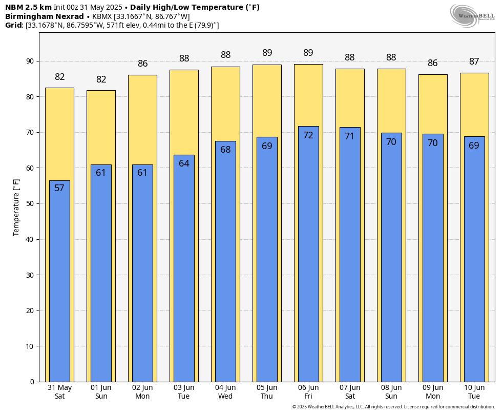
Saturday will bring a pleasant and quiet end to meteorological spring across Central and North Alabama. Mostly clear skies and light northwest winds will be the story for much of the day, with afternoon highs climbing into the low to mid 80s. Although the weather will be calm at the surface, smoke from Canadian wildfires may get pulled into the region aloft, leading to hazy skies and possibly a faint smell of smoke. No significant impacts are expected from the smoke.
On Sunday, a fast-moving upper-level disturbance will move through the area, leading to an increase in clouds and a chance of scattered, mainly afternoon showers and thunderstorms. The best chances for rain will be across North Alabama, though some activity could reach parts of Central Alabama as well. Rain chances will range from about 20 to 50 percent, with any storms staying below severe levels due to limited wind shear. The main concerns will be lightning and gusty winds with the stronger storms. Temperatures will generally remain in the 80s throughout the state.
By Monday, high pressure begins to build in at the surface while ridging aloft develops, setting the stage for a warm and humid pattern that resembles early summer. Southeast winds will help draw in a more moisture-rich airmass, and skies will remain mostly sunny. Highs will rise into the mid 80s to lower 90s across the region.
Tuesday will continue the trend of warm and muggy weather as the upper ridge strengthens over the eastern United States. Skies will be mostly sunny, and temperatures will again reach the mid 80s to lower 90s. Humidity levels will creep up slightly, making it feel even more like summer.
Wednesday brings more of the same, with partly to mostly sunny skies, highs in the mid 80s to lower 90s, and dew points in the 60s keeping the air feeling humid. The southeast flow remains in place, reinforcing the warm and moist conditions.
On Thursday, a frontal boundary will begin approaching the region from the northwest. While the ridge may limit how far south the front can advance, it will still increase the chances for showers and thunderstorms—especially in western and northwestern areas of the state. The highest rain chances will come during the afternoon and evening. Temperatures will be warm, ranging from the upper 80s to mid 90s.
By Friday, the front may linger near or just north of Alabama, helping to maintain elevated rain and storm chances across much of the area. Expect scattered showers and storms during the afternoon, with rain coverage in the 50 to 70 percent range. Widespread severe weather is not anticipated, but a few strong storms with gusty winds and lightning could develop. Highs will stay on the warm side, ranging from the mid 80s to mid 90s.
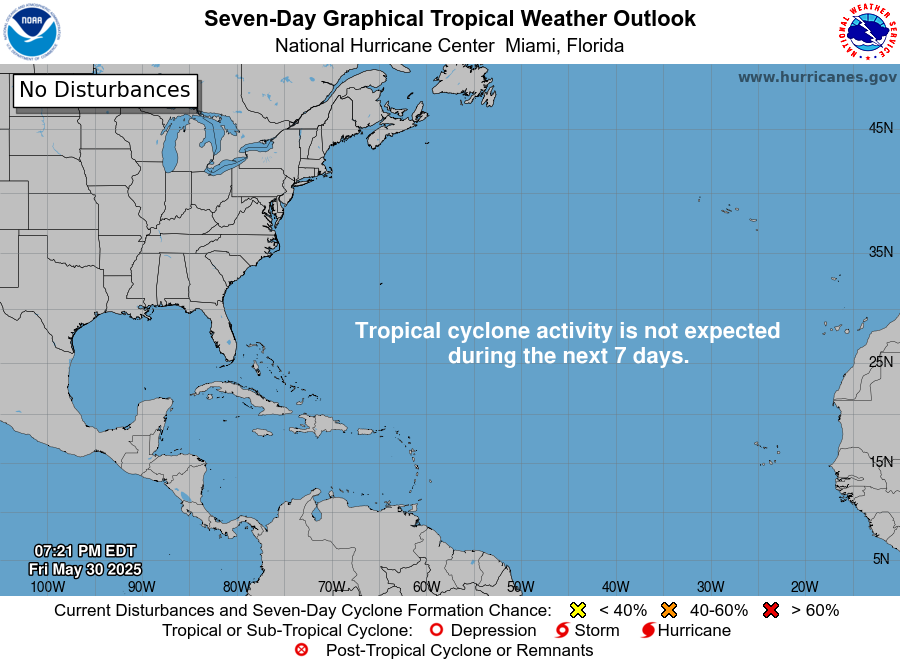
TROPICS: While the 2025 Atlantic Hurricane Season officially starts on Sunday, we’ll go ahead and start the Tropical Update today. For now, all the Atlantic Basin is free from any tropical mischief, and no new activity is expected over the next seven days.
Category: Alabama’s Weather, ALL POSTS, Social Media, Weather Xtreme Videos