

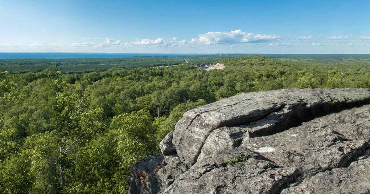
Hiking the Cup and Saucer Trail on Manitoulin Island is a must for outdoor lovers in Ontario. Here’s everything you need to know, from the easy main loop to the ladders and rock scrambles of the Adventure Trail.
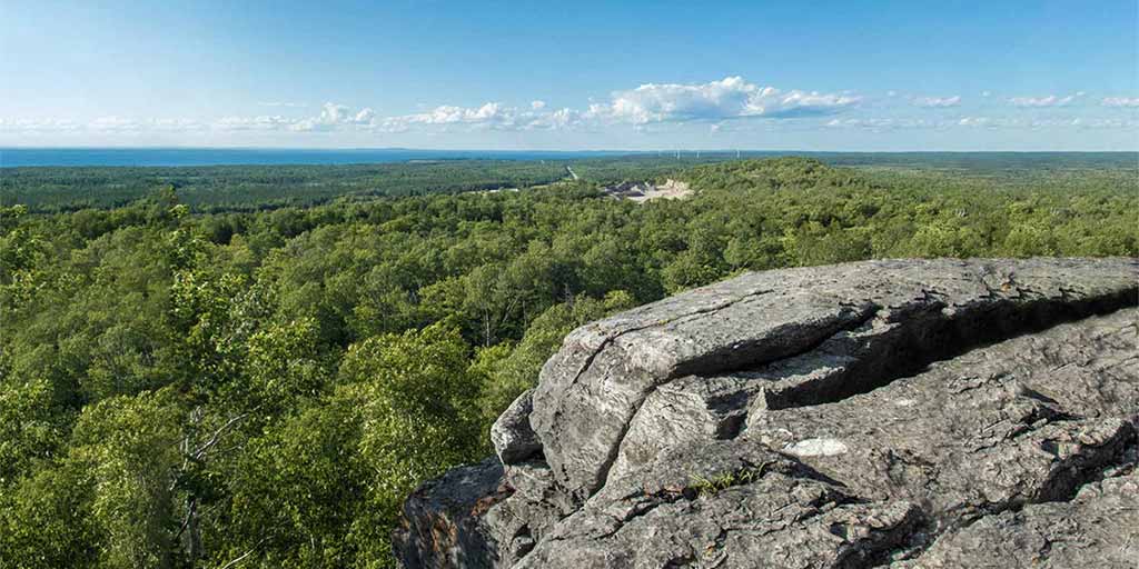
Manitoulin Island is blessed with some phenomenal hiking trails. But of all the amazing things to do on Manitoulin Island, none are more famous than the epic Cup and Saucer Trail.
This is one of the best hikes in Ontario, and one of my family’s favorite hikes anywhere. Its cliffs rise some 70 meters (230 feet) above the surrounding forest, stretching more than two kilometers along the Niagara Escarpment, and the views from the top reach clear across Manitoulin Island to Lake Huron’s North Channel. Best of all, it’s built with trails that fit many skill levels. There’s a manageable main hiking loop that most families can handle, a longer escarpment route for those who want a longer day hike, and a short, wild Adventure Trail for anyone who wants a proper scramble.
The first time my family hiked the Cup and Saucer Trail, my youngest son Dylan was two years old. We stuck to the main loop that day, and even that felt like a triumph. On a later hike, when the boys were nine and six, they spent the afternoon squeezing through rock crevices, hauling themselves up weathered wooden ladders, and grinning like they’d conquered a mountain on the Adventure Trail. Which, in a small way, they had.
We’ve now visited Manitoulin at least ten times, and this trail is the one we keep coming back to. Here’s how to hike it with your family, whatever their ages and abilities. For more of the island, see my guide to the best things to do on Manitoulin Island.
Quick Planner: The Cup And Saucer Trail
Where: Highway 540 near M’Chigeeng, about 20 km (12 miles) west of Little Current on Manitoulin Island.
Distances: Roughly 12 km of trails in total. The main loop is about 4 km, the south loop adds around 5 km, and the Adventure Trail is a 500-meter adventurous side route.
Time: Around 1.5 hours for the main loop at a good clip, or 3 hours with kids. Allow 4 or more hours to add the south loop.
Difficulty: Easy to moderate on the main and south loops. Strenuous on the Adventure Trail, with ladders, boulders, and tight crevices.
Facilities: Portable toilets at the parking lots in high season, but nothing on the trail itself. Bring your own water.
Plan-ahead alert: The lot holds about 50 cars and fills up on summer long weekends, so arrive early. The conservancy that manages the trail asks visitors to contribute to parking, so bring some cash.
Don’t miss: The East Lookout and a stop at Mum’s Bakery in Mindemoya afterward.
What is the Cup and Saucer Trail And Why Is It So Popular?
The Cup and Saucer is the signature hike on Manitoulin Island, the largest freshwater island in the world. It climbs to one of the island’s highest points, where a long band of exposed dolomite cliff opens onto a sweeping view over forest, farmland, and water.
The land carries a deep Indigenous history, as does the entire island. Artifacts from the nearby Sheguiandah archaeological site show human presence dating back 10,000 years, marking it as one of the oldest continuously significant places in North America. The Cup and Saucer trail was used by First Nations peoples long before Europeans arrived. In Ojibwe, it’s known as Michigiwadinong, often translated as “bluff in the shape of a spearhead.” Legend tells of Nanabush, the trickster figure of Anishinaabe storytelling, fleeing Iroquois warriors and laying down his spearpoints here, forming the shape of the bluff. You’ll find the story on a sign near the trailhead, and it’s well worth reading aloud to the kids before you start climbing.
Geologically, the cliffs are part of the Niagara Escarpment, the same limestone and shale spine that runs down through the Bruce Peninsula to Niagara Falls, laid down hundreds of millions of years ago when this was all a shallow tropical sea. The preserve is owned and cared for by the Escarpment Biosphere Conservancy, a land trust that protects properties along the escarpment, with the trail maintained largely by volunteers.
The traditional name of the Cup and Saucer Trail, though is actually “Michigiwadinong.” Michigiwadinong is Ojibway, meaning “bluff in the shape of a spearhead.” The traditional name is presented on a sign near the trailhead along with the Ojibway story behind the trail. It shares that Michigiwadinong is where Nanabush lay down his spearpoints while fleeing from Iroquois warriors. Nanabush, a trickster and cultural hero, had been tormenting the Iroquois for generations.
Boasting cliffs 70 meters (230 ft) high that stretch for over 2 km (1.25 miles), the Cup and Saucer Trail snakes through deep forest and offers some of the best views on Manitoulin Island. These formations create a landscape that varies a lot over short distances. The formations have made the Cup and Saucer Trail a genuine treat to hike. Each short stretch offers a unique landscape, making for a thought-provoking, challenging, and beautiful hiking environment.
Where is the Cup and Saucer Hiking Trail?
The Cup and Saucer trailhead sits on Highway 540 just outside the First Nation community of M’Chigeeng, roughly 20 km (12 miles) west of Little Current. It used to be tucked at the junction of Bidwell Road, which caused confusion for those without local knowledge, but it’s now marked with a large highway sign and is much easier to spot.
Address: 4097 ON-540, Sheguiandah, ON P0P 1W0 GPS: 45.863711, -82.105127
Parking is served by a two-level gravel lot holding around 50 cars, with the lower level closest to the trailhead and an upper overflow area connected by side trails. Portable toilets are usually available in both lots during peak season. The Cup and Saucer parking lot fills up on summer weekends and holidays, so come early if you can. M’Chigeeng is about a five-minute drive away and has groceries and a gas station for those who need food and supplies.
Getting To Manitoulin Island
If you’re coming from southern Ontario, the most scenic route is taking the scenic Chi-Cheemaun ferry near Tobermory and Bruce Peninsula National Park. This two-hour crossing stretches across Lake Huron from Tobermory, on the Bruce Peninsula, to South Baymouth on Manitoulin Island. The Ferry runs seasonally from the beginning of May to mid-October.
Alternatively, and for those driving from northern Ontario, you can drive onto the island year-round via the one-lane swing bridge at Little Current, about a 90-minute drive from Sudbury.
The Cup And Saucer Trails: Routes And Distances
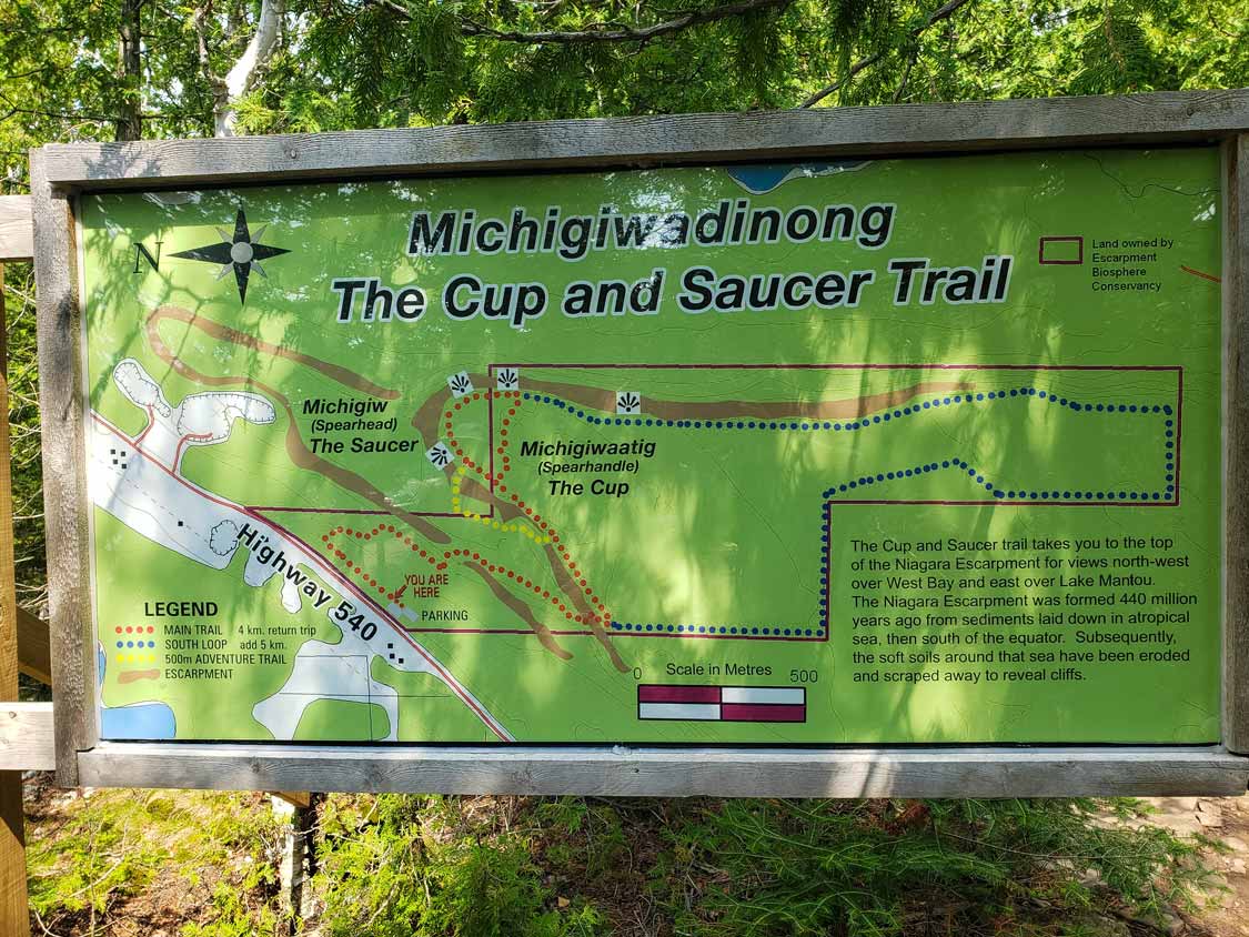
There are roughly 12 km of trails woven into the Cup and Saucer hiking route, split into three distinct hiking experiences. Depending on the route that you choose, hiking times to the most popular viewpoints can range from about 20 minutes up to 4 hours for the full loop, including the Adventure Trail.
The Main Loop (Red Loop), Easy To Moderate
The main Cup and Saucer trail is a loop of about 4 km (2.5 miles) that climbs steadily through mixed forest to the escarpment edge and the East Lookout, the classic Cup and Saucer viewpoint. Strong hikers can knock it off in an hour to an hour and a half with stops. If you’re hiking with kids, give yourself about three hours so nobody feels rushed.
The main trail is well marked and well traveled, which makes navigation easy. One thing to watch: There’s a side trail that branches off to the left near the start, and you’ll want to stay right to remain on the main route. The Cup and Saucer Main Loop is quite a popular hike, so if you do find yourself a little misplaced, you likely won’t wait long before stumbling across another group of hikers.
The South Loop (Blue), Easy To Moderate
If you have the time and the legs, the South Loop adds roughly 5 km, bringing the total Cup and Saucer hike to around 9 km. It runs along the length of the Niagara escarpment and is mostly flat once you’re up top, delivering a series of smaller lookouts and quiet forest walking with far fewer people. In my opinion, it’s well worth the extra time.
The Adventure Trail (Yellow), Strenuous
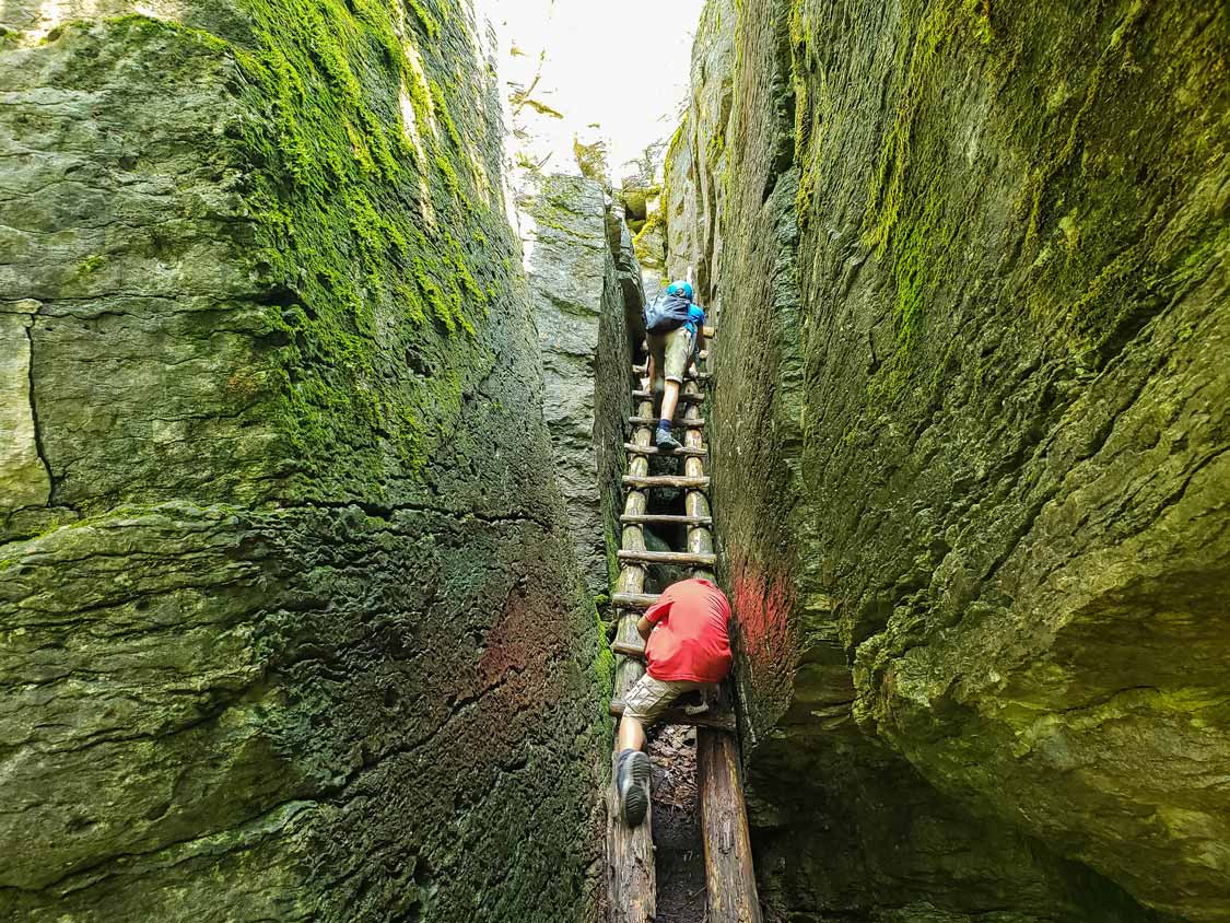
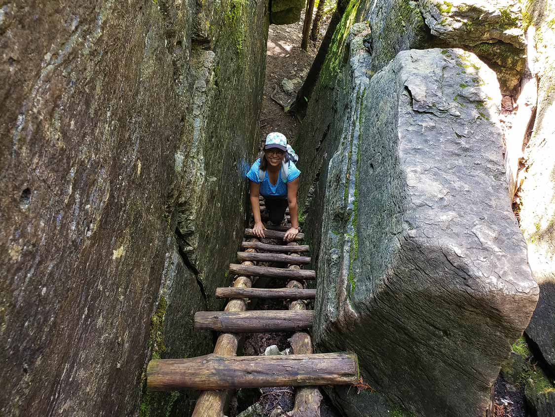
This is the Cup and Saucer hiking trail that most people talk about. The Adventure Trail is only about 500 meters long, branching off midway up the main trail, but it packs in more fun per step than any other hike on Manitoulin Island. Expect to scramble over and sometimes through jumbled rock falls, squeeze through narrow crevices in the escarpment, and climb a series of weathered wooden ladders that look completely unsafe before a stairway delivers you close to the East Lookout.
For the challenge, I’d put it on par with the Crack in Killarney Provincial Park. It’s strenuous and requires thinking and creativity, but it’s doable for most experienced hikers. You’ll want decent hiking shoes with grip, since the rock gets slippery, and some of the older ladders have missing rungs, so test each one before you trust it with your weight. A volunteer crew works on this route regularly, so conditions do change. If you get turned around, the rule of thumb is to keep the cliff wall on your right.
Can young kids do it? Ours did, with supervision and a hand here and there. Cohen, at nine, had no issues at all. Dylan, at six, needed help on a few sections. If your kids are small, or if anyone in your group is uneasy with heights or tight spaces, the main loop is plenty rewarding on its own. There’s no shame in skipping it, and it is absolutely no place to be reckless.
Our Experience Hiking The Cup And Saucer Trail
Our most recent Cup and Saucer hike came at the start of a Northern Ontario road trip that would eventually take us through Sudbury to Thunder Bay. We started our day with a North Channel cruise out of Little Current before heading for the Cup and Saucer Trail.
The main trail was a blast, with loads of fun areas to explore, from cool deadfall to small hills that the boys treated as obstacle courses. But the moment we stepped onto the Adventure Trail, the energy shifted. The boys loved scrambling over (and sometimes through) the rock falls, and the tight squeezes between boulders had them giggling. We did lose the route briefly at an old junction, and the fix was exactly what the guidebooks say: head back to the rock wall and follow it.
There’s one part of the day I still laugh about. Near the end, sweaty and tired, we came across an old ladder leading up toward the East viewpoint. Before I could say anything, the boys were climbing up and out of sight. The ladder was old and missing rungs near the bottom, but it was still easy enough to mount, and at the top we scrambled over boulders and pushed through an overgrown stretch back to the main trail. We stopped at the East Lookout for a snack and the view, and only then did we spot a sign for the Adventure Trail pointing back at 75 meters of route we’d somehow bypassed entirely. Naturally, we hiked it on the way back down so we could finish the route.
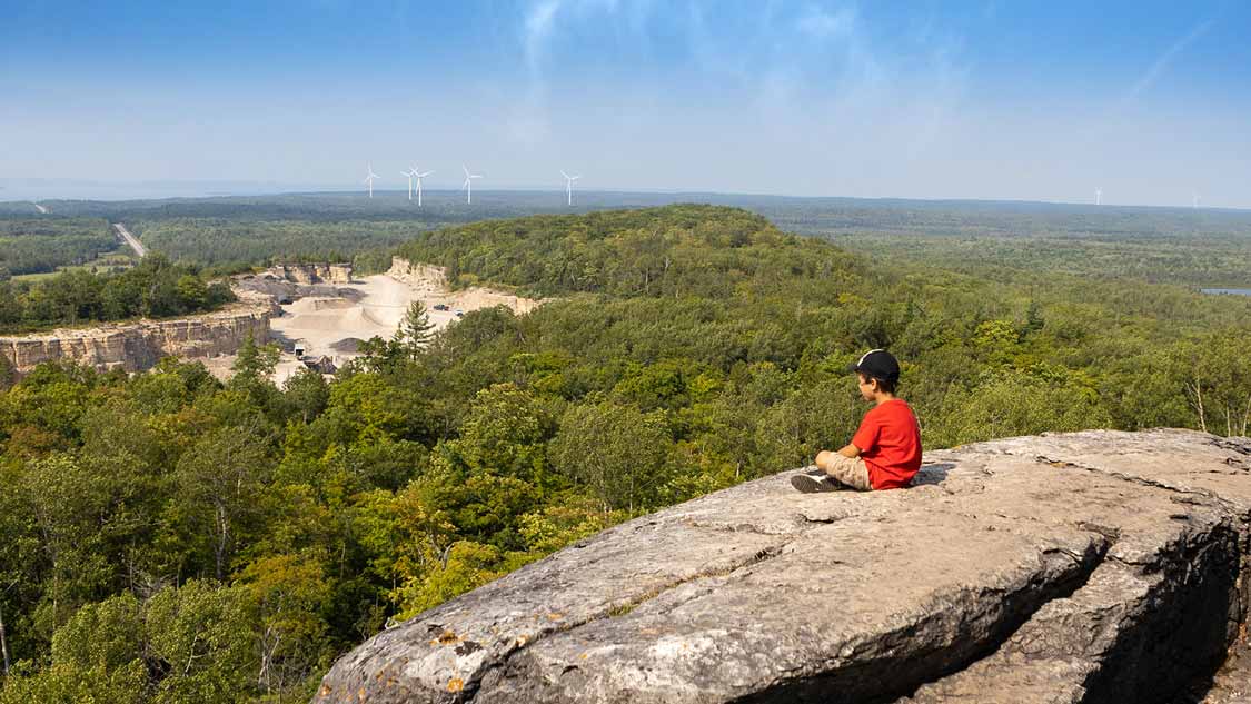
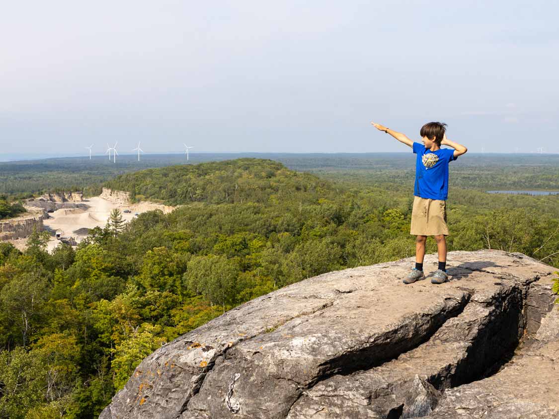
The East viewpoint has changed over the years. A rock quarry has expanded below, and the scarred earth was noticeably worse than on our visit two years earlier. It doesn’t ruin the panorama, but it’s there, and it’s worth knowing before you go. And a final word of encouragement: a reader wrote in to tell me he’d done the full hike, Adventure Trail included, at 61 years old, and loved every minute. This trail will reward anyone willing to take their time.
Tips For Hiking The Cup And Saucer Trail
- Tell someone your plan, especially if you’re taking on the Adventure Trail. Getting lost or hurt out here is a real possibility.
- Don’t count on your phone. Cell service is patchy on and around the trail.
- Test the ladders before putting your weight on them; some rungs are missing or worn.
- Wear proper footwear. Good hiking shoes with grip are essential for the Adventure Trail and a very good idea everywhere else.
- Bring water and snacks. There’s nothing on the trail, so carry everything you’ll need. A filtered water bottle is a good call.
- Consider hiking poles if you like extra support on hilly terrain.
- Keep dogs leashed, and be aware of hunting seasons in the surrounding area.
- Pack it in, pack it out. There are garbage bins at the trailhead, so leave the trail as clean as you found it.
- Arrive early to get a parking spot and have the lookouts to yourself.
Family Hiking Tips, Guides, and Inspiration
Looking for more great family hiking tips, inspiration, and gear guides from those who have hit countless trails around the world? Check out these other articles on Wandering Wagars – Adventure Family Travel.
When Is The Best Time To Hike The Cup And Saucer?
The Cup and Saucer hiking trail is at its best from late spring through fall. Early autumn is spectacular, when the hardwoods along the escarpment turn, and the lookouts open onto a sea of red and gold. Late spring and early summer bring wildflowers, including rare orchids in the surrounding habitat, and greener, cooler hiking. Summer is the busiest season by far, so aim for a weekday or an early start. Sunrise at the East Lookout is magic if you’re willing to set an alarm.
In winter, the trail isn’t maintained, and the cliff edges and Adventure Trail become dangerous. I don’t recommend attempting the hike during the winter unless you are experienced and properly prepared.
Facilities And Services on the Cup and Saucer Trail
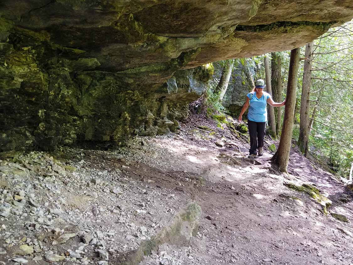
The trail itself has no services at all: no water, no shelters, no washrooms. At the trailhead you’ll find the two parking lots, garbage bins, and portable toilets during the high season. The First Nations community, M’Chigeeng, is five minutes away, has restaurants and picnic areas by the lake, and it’s worth stopping at the Ojibwe Cultural Foundation and local artisan shops while you’re there.
The Great Spirit Circle Trail was a local experience that offered guided hikes that teach the medicinal uses of local plants, canoe outings, drum-making workshops, and teepee glamping. Unfortunately, it closed down, and there is no indication that it will reopen.
Where To Eat Near The Cup and Saucer Hike
Half the fun of a Manitoulin hike is what comes after. Mum’s Bakery in Mindemoya is famous for its apple fritters, and it’s the one place on the island where we’ve reliably found a crowd. Farquhar’s Dairy ice cream is sold all over Manitoulin and is exactly what tired kids deserve. For dinner, Lake Huron Fish and Chips in Providence Bay does a fresh battered whitefish that’s hard to beat, and the Manitoulin Island Brewing Company makes a lager called Mr. Canoehead, which won me over on name alone. Gone with the Family has a great guide of Manitoulin Island restaurants that’s worth checking out.
Where To Stay Near The Cup And Saucer Trail
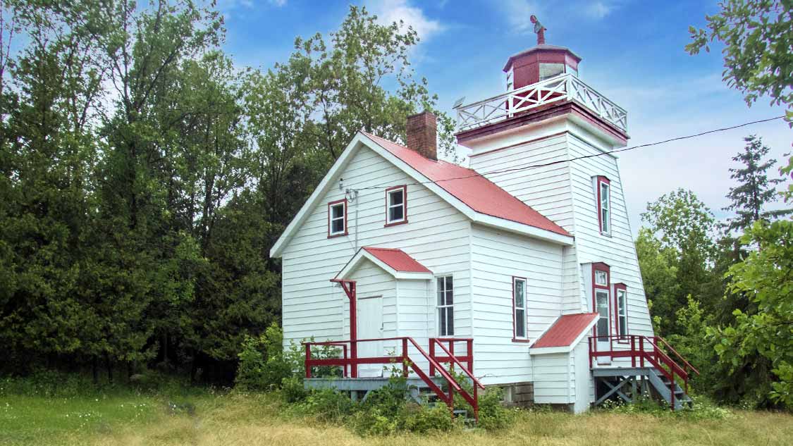
Manitoulin has everything from waterfront resorts to rustic campgrounds, and the island is big enough that it’s worth basing yourself close to what you want to do. For hotels, inns, and cottages, see my guide to the best Manitoulin Island hotels. If you’d rather sleep under canvas, my Manitoulin Island camping guide covers the best campgrounds and parks on the island.
Our Manitoulin Island Cup And Saucer Hike Video
Interested in learning more and seeing more of this awesome hike? Check out our Cup and Saucer video on YouTube. Don’t forget to like and subscribe to help support us and let us bring you more fun adventure family travel content.
Frequently Asked Questions About The Cup And Saucer Trail
There are roughly 12 km of trails in the network. The main loop is about 4 km, the south loop adds around 5 km for a total near 9 km, and the Adventure Trail is a 500-metre side route.
Plan on 1.5 hours for the main loop at a brisk pace, or about 3 hours with kids. Adding the south loop makes it a 4-hour-plus outing.
The main and south loops are easy to moderate, with a steady climb and some rocky footing. The Adventure Trail is strenuous, with ladders, boulder scrambles, and narrow crevices.
Yes. We first hiked it when our youngest was two, sticking to the main loop. The Adventure Trail suits confident kids with supervision, though small children may need help on the ladders and squeezes.
The preserve is managed by the Escarpment Biosphere Conservancy, which asks visitors to contribute toward parking and upkeep. This is a voluntary donation. If you want to contribute, bring cash and check the conservancy’s site for current arrangements before you go.
On Highway 540 near M’Chigeeng, about 20 km west of Little Current on Manitoulin Island, at 4097 ON-540, Sheguiandah.
Yes, on leash.
Sturdy hiking shoes, plenty of water, snacks, and layers. There’s no water or shelter on the trail, and cell service is unreliable.
Are You Ready To Hike The Cup And Saucer Trail?
Few hikes in Ontario give you as much value for the effort as this one. You get a First Nations story worth telling your kids, cliffs with views over the world’s largest freshwater island, and a section wild enough to make a nine-year-old feel like a mountaineer. It’s earned its spot among my favorite hikes in Ontario, and it’s a hike we’ll keep coming back to for as long as the boys will come with us.
Have you hiked the Cup and Saucer Trail? Drop a comment below or tag your photos @wanderingwagars. We’d love to see them. For more family hiking inspiration, see my roundup of the best hiking destinations for families.
You May Also Like To Read:
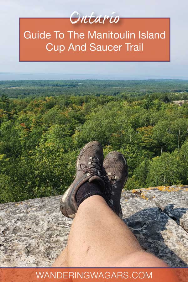
Pin This For Later:
Wandering Wagars is a participant in the Amazon Services LLC Associates Program, an affiliate advertising program designed to provide a means for sites to earn advertising fees by advertising and linking to amazon.com, amazon.co.uk, amazon.ca. Amazon and the Amazon logo are trademarks of Amazon.com, Inc. or its affiliates.