DRY DAY AHEAD: Dry weather continues across Alabama today, but clouds will increase this afternoon as temperatures rise into the 55-62 degree range.
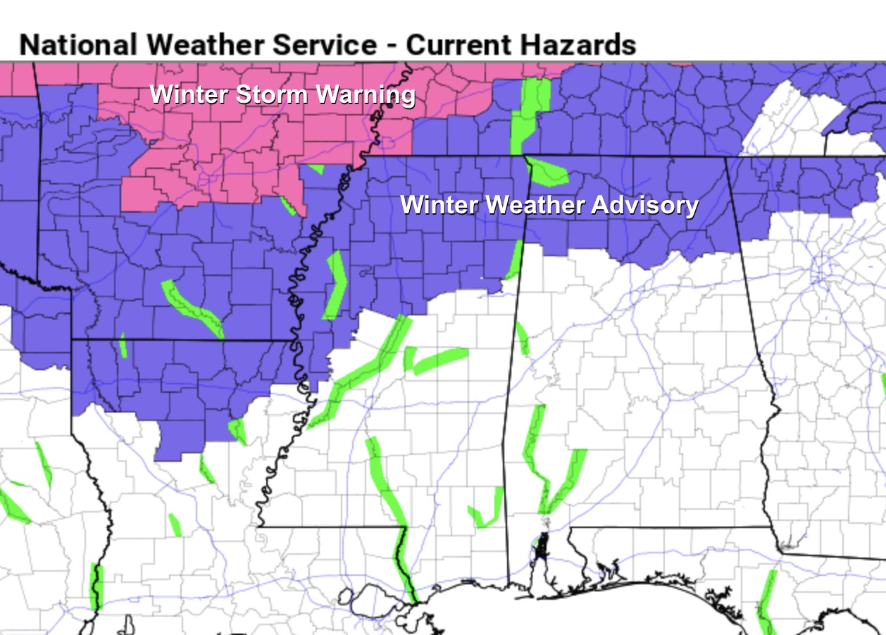
WINTER WEATHER ADVISORY: A disturbance will bring rain to much of Alabama tonight, but wintry precipitation is likely tonight over the northern counties where cold air remains in place. A winter weather advisory is in effect along and north of a line from Hamilton to Cullman to Gadsden to Centre.
Screenshot
A “wintry mix” of snow along with some sleet and freezing rain is likely after midnight tonight over the northern quarter of the state, and some travel impact is likely due to icy conditions mainly on bridges. The precipitation will end by 6:00-7:00 a.m. tomorrow, but temperatures will struggle to rise above freezing in this area, so some slick spots could linger through the day.
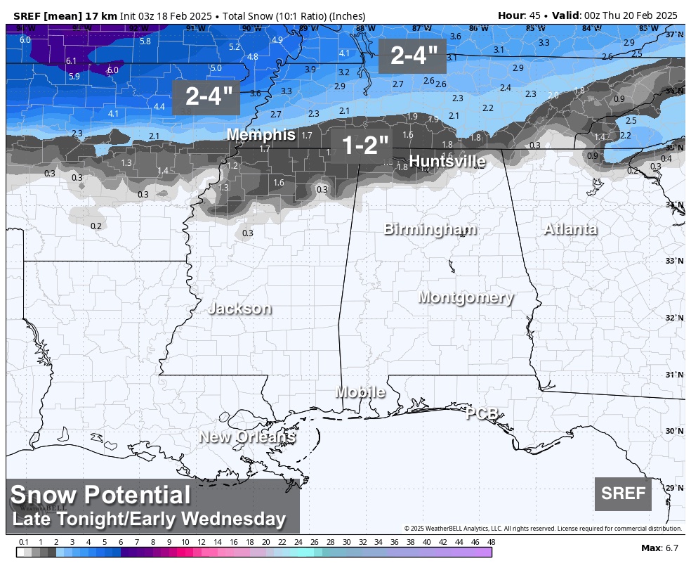
Snow accumulation will be in the 1/2 to 1 inch range for the western half of the Tennessee Valley, with isolated heavier amounts.
Places like Tuscaloosa, Birmingham, and Anniston and points south will see light rain with temperatures above freezing. The rain will clear Southeast Alabama by late morning and the afternoon will be dry.
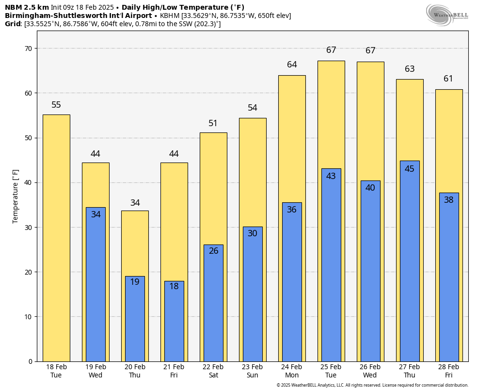
FRIGID AIR: Very cold, Arctic air will arrive tomorrow night, and North Alabama will drop into the teens both Thursday and Friday morning. Wind chill indices will be in the single digits Thursday morning. A freeze is likely down to the Gulf Coast Friday morning, where Gulf Shores and Orange Beach will likely reach the 20s.
The air will be dry and the sky will be mostly sunny Thursday and Friday.
THE ALABAMA WEEKEND: Dry weather continues over the weekend with a warming trend; highs will be mostly in the 50s, but South Alabama will see 60s Sunday afternoon.
The weather will be dry for the first half of next week; global models now suggest the next chance of rain will come on Thursday (February 27). See the video briefing for maps, graphics, and more details.
ON THIS DATE IN 1992: A thunderstorm spawned a powerful F4 tornado for so far north for the time of the year in southern Van Wert County in Ohio. The tornado touched down just west of US Route 127 and traveled northeastward for about 3 miles. One house was completely leveled, and nine others experienced severe damage. Six people were injured.
Look for the next video briefing here by 3:00 this afternoon… enjoy the day!